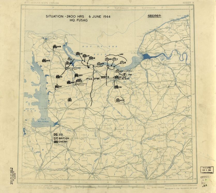
Dated June 6, 1944, this US Twelfth Army Group situation map shows the presumed locations of Allied and Axis forces on D-Day, when Allied troops landed on the beaches of Normandy. Drafted during the war, the content in this historical map reflects the information that operational commander, General Omar N. Bradley, would have had on hand at the time.
We would like to thank Crown Family Philanthropies, Abe and Ida Cooper Foundation, the Claims Conference, EVZ, and BMF for supporting the ongoing work to create content and resources for the Holocaust Encyclopedia. View the list of donor acknowledgement.