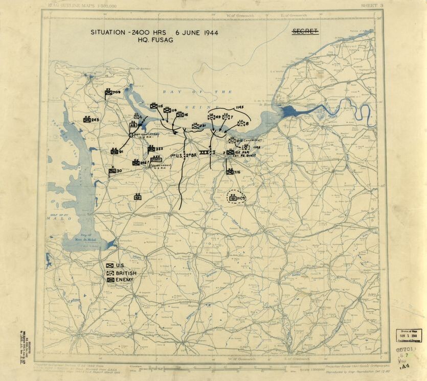
Diese Lagekarte der US 12th Army Group vom 6. Juni 1944 zeigt die vermuteten Standorte der Alliierten und der Achsenverbündeten am D-Day – dem Tag, an dem alliierte Truppen an den Stränden der Normandie landeten. Diese während des Krieges erstellte historische Karte spiegelt die Informationen wider, die dem Befehlshaber der Operation, General Omar N. Bradley, zu diesem Zeitpunkt zur Verfügung standen.
We would like to thank Crown Family Philanthropies, Abe and Ida Cooper Foundation, the Claims Conference, EVZ, and BMF for supporting the ongoing work to create content and resources for the Holocaust Encyclopedia. View the list of donor acknowledgement.