Browse an alphabetical list of geographic and thematic maps that depict important locations before, during, and after the Holocaust and World War II. These maps also show sites of camps, ghettos, and mass killings, and various geographical movements, such as military operations, deportations, or invasions.
<< Previous | Displaying results 1-5 of 5 for "Map" | Next >>


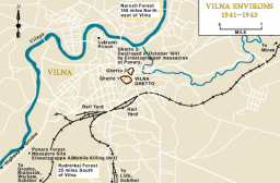
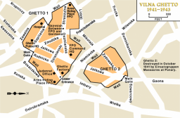
Map showing the boundaries of and key locations within the Vilna ghetto in occupied eastern Europe

The plight of German-Jewish refugees, persecuted at home and unwanted abroad, is illustrated by the voyage of the SS "St. Louis." On May 13, 1939, the SS "St. Louis," a German ocean liner, left Germany with almost a thousand Jewish refugees on board. The refugees' destination was Cuba, but before their arrival the Cuban government revoked their permission to land. The "St. Louis" was forced to return to Europe in June 1939. However, Great Britain, France, Belgium, and the Netherlands agreed to accept the…


We would like to thank Crown Family Philanthropies, Abe and Ida Cooper Foundation, the Claims Conference, EVZ, and BMF for supporting the ongoing work to create content and resources for the Holocaust Encyclopedia. View the list of donor acknowledgement.