Map
Browse an alphabetical list of geographic and thematic maps that depict important locations before, during, and after the Holocaust and World War II. These maps also show sites of camps, ghettos, and mass killings, and various geographical movements, such as military operations, deportations, or invasions.
<< Previous | Displaying results 11-20 of 44 for "Map" | Next >>
-
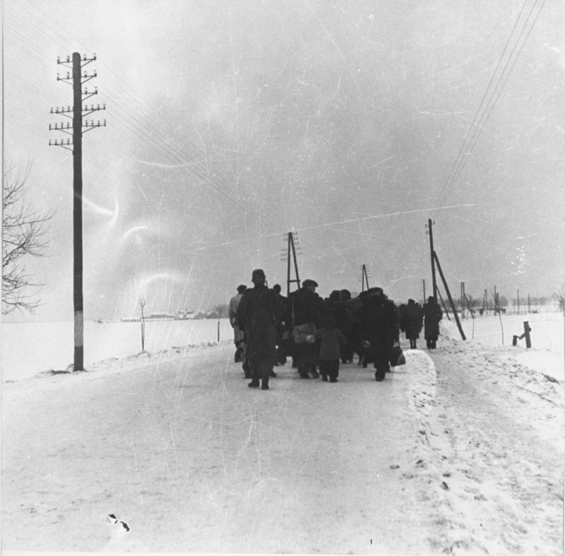
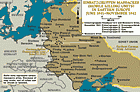
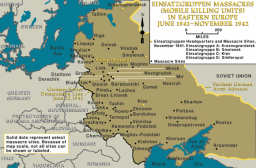
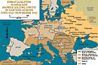
Einsatzgruppen massacres in eastern Europe (enlargement)
MapEinsatzgruppen were German special duty units, composed primarily of SS and police personnel, assigned to kill Jews as part of the Nazi program to kill the Jews of Europe. During the invasion of the Soviet Union in June 1941, the mobile killing squads followed the German army as it advanced deep into Soviet territory, and carried out mass-murder operations. Wherever the Einsatzgruppen went they shot Jewish men, women, and children, without regard for age or gender. Einsatzgruppen killed more than a…
-
-
-
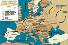
Escape routes from German-occupied Europe, 1942
MapThroughout most of German-occupied Europe, the Germans sought to round up and deport Jews to killing centers in occupied Poland. Some Jews survived by hiding or escaping from German-controlled Europe. Some escape routes out of occupied Europe led to belligerent states (such as the Soviet Union), neutral states (such as Switzerland, Spain, Sweden, and Turkey), and even to states allied with Germany (such as Italy and Hungary before they were occupied by Germany). After the German attack on the Soviet Union,…
-
-
-

-
-

-